Over 300,000 km of dirt roads20 regions

Every dirt road in Italy, at your level

Find dirt roads for maxi enduro, dual sport, enduro and MTB and, with an MTB, trails too, know the level, surface and bans before you go, join stretches into an itinerary with the transfers already worked out and download the GPX track for the navigator you already use.

Free GPX and 30 days of Explorer Plus, no card needed

Dirt roads of the Upper Susa Valley in 3D, coloured by difficulty level
Upper Susa Valley
  • Easy
  • Moderate
  • Challenging
  • Hard
  • Extreme
peakpassprotected areauseful spotsstretch with a bangates and fords
01What it solves

The right ride isn’t found by chance

The questions you ask before every ride, and where OffMap answers them.

Where are the dirt roads around here?

Dirt roads for all, trails for MTBs

About 47,500 dirt-road networks from OpenStreetMap across 20 regions, each with its level for your vehicle. With an MTB, 145,351 km of trails too; on a motorbike they don’t appear.
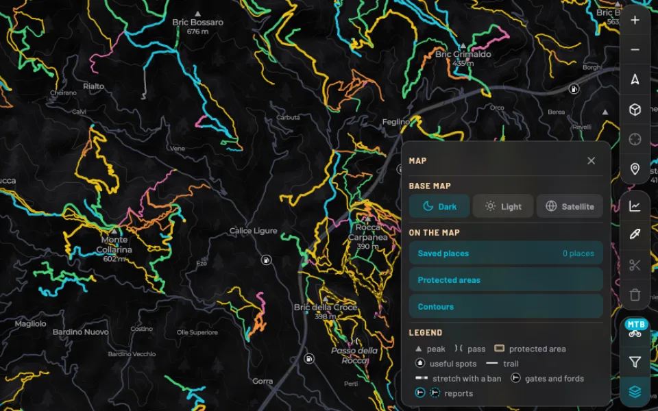
The app map in the hills behind Finale Ligure with an MTB: dirt roads and, thinner, trails coloured by level, with the legend open on the ‘trail’ entry

Can my bike handle it?

The level worked out for your vehicle

Gradient, surface and twistiness give every stretch a level, from easy to extreme, different for maxi enduro, dual sport, enduro and MTB. Filter the map and see only what suits you.

A network card in the app for a dual sport: highest level Extreme, the bar of km by level, mostly moderate, and the extreme stretch lit on the map and the elevation profile

Can I ride through?

Access, before you go

Map-data bans, the parks and reserves it crosses and the regional rule on motor traffic, on every network. With Explorer Plus the AI looks for today’s council orders and gives you the source.

Is it worth it?

Hear from those who rode it

Every network has reviews from the explorers who rode it: rating, comment and photos. Quick filters show the top-rated and most downloaded networks straight away.

How do I build my ride?

Itineraries made to measure

Join networks into a loop or a one-way ride, or set a start and finish and OffMap threads the dirt roads along the way. With ‘Linear’ you follow each network’s main line and the side branches stay out. Transfers already worked out and a free preview.

318,152 kmof dirt roads on the map
47,595networks with name and level
145,351 kmof trails for MTBs
5 levelsfor each of the 4 vehicles
02How you use it

From idea to track in five steps

Plan on OffMap, ride with OsmAnd, Garmin, Wikiloc or the navigator you already use.

  1. Step 1

    Find an area

    A village, a pass, pasted coordinates or a network id: the map takes you there, with peaks, passes, parks, mountain huts and water points.

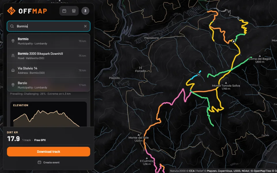
    Search in the app: ‘Bormio’ in the field and the list with the municipality, a road and an address
  2. Step 2

    Pick networks at your level

    Every network has a name, km, elevation profile, weather and reviews from other explorers. Save the ones you like for later.

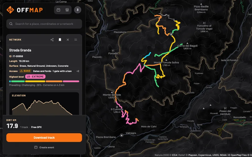
    A network card in the app: highest level, bar of km by level, length, surface, access with the ‘Bans’ badge, elevation profile and, at the bottom, the choice between whole network and main line next to the button to download the track
  3. Step 3

    Join and fine-tune

    OffMap lines them up and works out the transfers; with Explorer Plus you cut, remove a stretch, change the order and move the road with a waypoint.

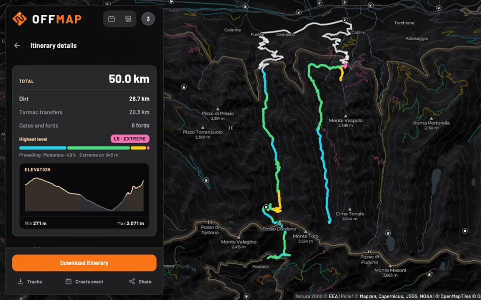
    An itinerary in the app: two dirt-road networks joined by tarmac transfers, 50 km in total with gates and fords, highest level and elevation profile
  4. Step 4

    Download the GPX

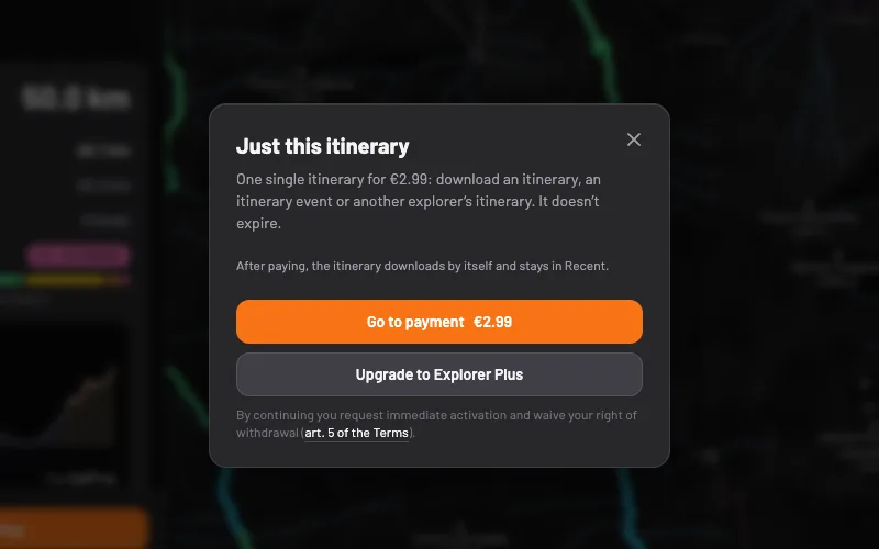
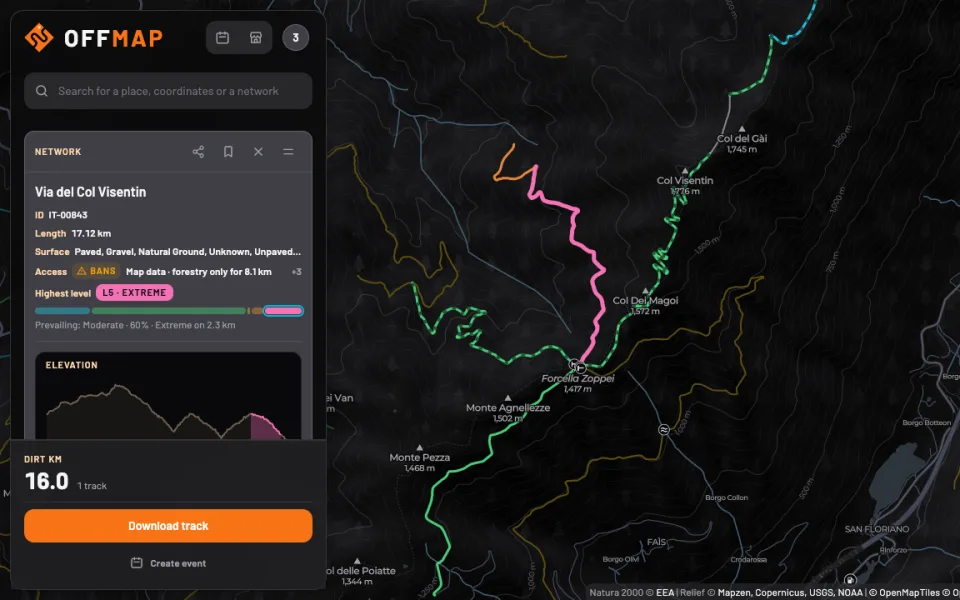
    Every network’s track is free, whole or just its main line, the longest road without the side branches; an itinerary downloads with Explorer Plus or with a single itinerary for €2.99. The file carries stretch names and access notes.

    A network card in the app with ‘Main line’ chosen: the main line’s km out of the network’s, ‘Free GPX’, the ‘Download track’ button and on the map the line coloured by level with the side branches dashed
  5. Step 5

    Ride with your navigator

    Open the track in OsmAnd, Garmin, Wikiloc or the app you already use, or share it with a link: whoever rides with you sees it without signing up.

    Strada Fusine-FoppoloGPX · 16.3 km
    ElevationMin 1,126 mMax 2,071 m
    Open it in
    OsmAndGarminWikiloc
    or any app that reads a GPX
03And also

Everything around the ride

The small things that matter when you plan a ride, share it or ride it again.

A map that reads the terrain

3D, satellite and light views, contour lines down to every 50 m, peaks and passes with height, parks and reserves with their boundary, mountain huts, fuel stations and water points.

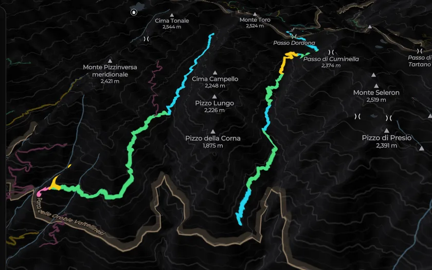
The 3D map between Valtellina and Val Brembana: dirt roads coloured by level, peaks and passes with height, contour lines, mountain huts and a park boundary

Bans, gates and fords

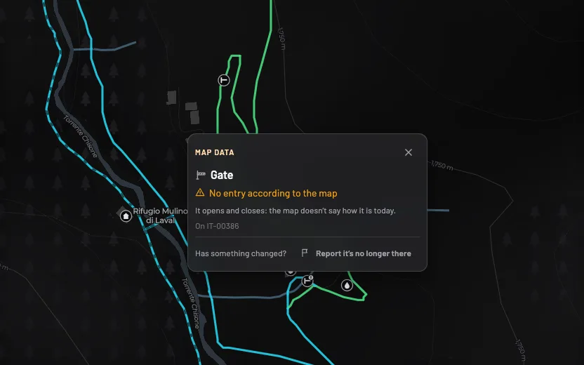
Up close, stretches with a ban in the map data for your vehicle are dashed, and gates, barriers and fords have their own mark. Tap to see what it is; if it has changed, report it. Map data doesn’t show everything.

The app map in Val Chisone: stretches dashed for a ban in the map data, the marks of gates and fords and the box ‘Map data · Gate · No entry according to the map’

Search your way

Places, streets, hamlets, coordinates in any format or a network id.

Save networks and places

Find them in your profile and on the map, also as Route stops.

Share with a link

Whoever opens it sees the track on the map, no account needed, for 30 days.

Weather and elevation

The forecast for the next 7 days at the network’s height and the profile of every track.

Events and businesses

Post a ride from a track or join the ones in your region, including those of workshops, hire firms and schools. On the map you find businesses near your ride, with opening hours and contacts.

Points, goals and challenges

Every new km of dirt earns points. Monthly goals, regions explored and a 14-day challenge with other explorers; ‘My map’ lights up what you’ve already ridden.

04For businesses

Run a business? Put it on the map

Workshops, hire, schools, tracks, places to stay and clubs: with OffMap Business, riders planning a ride in your area find you, see your hours and services and join your events.

  • On the businesses mapBy type and vehicle served, sorted by distance: nobody pays to be higher up.
  • Events on the boardRides, courses, test rides and new-model launches, alongside those of other explorers.
  • Reviews from people who cameOnly from people who joined one of your events.
Discover OffMap Business

Free until 31 December 2027

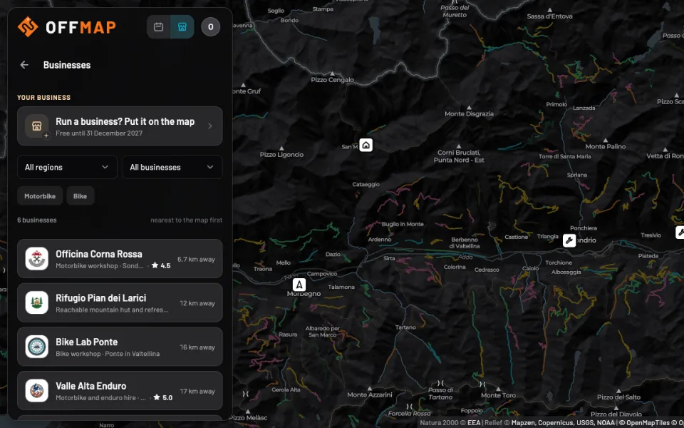
The app’s ‘Businesses’ layer in Valtellina: the ‘Run a business? Put it on the map’ row, the filters and four example businesses sorted by distance, with their marks on the map
05Where

Over 300,000 km of dirt in 20 regions

Tap a region: networks, kilometres and levels for your vehicle.

Italy

20 regions

Dirt318,152 km
Networks47,595

Including 11 networks in San Marino.

With an MTB, 145,351 km of trails too.

Networks by level
Maxi enduro
Dual sport
Enduro
MTB
  • Easy
  • Moderate
  • Challenging
  • Hard
  • Extreme
The longest networks
  1. Trazzera Mandanici - Piano Margi · Sicily295.3 km
  2. Scala Palaceris · Sardinia264.1 km
  3. Dorsale dei Peloritani · Sicily240.5 km
All regions
06Plans and pricing

Tracks are free, Plus does the rest

Every network’s GPX is free, itineraries with Explorer Plus or a single itinerary. 30 days of Plus when you sign up.

Explorer

Signing up is free and the GPX of every network downloads for free, as often as you like. An itinerary that joins several networks downloads with a single itinerary, no subscription needed.

  • Free GPX of every network, several networks too
  • Just a network’s main line too, free
  • Access: bans, protected areas and regional rule
  • Itinerary preview, download with a single itinerary
  • Events board and one active ride
  • AI check of today’s council orders
  • Advanced editing tools
  • Saved custom itineraries
Single itinerary
One itinerary€2.99
Start for free

Explorer Plus

Every itinerary included: cut, join and reorder as you like.

  • Free GPX of every network, several networks too
  • Just a network’s main line too, free
  • Access: bans, protected areas and regional rule
  • Preview and download of every itinerary
  • Events board and unlimited rides, also from an itinerary
  • AI check of today’s council orders
  • Advanced editing tools
  • Saved custom itineraries
Subscription
Monthly€4.99 /month
Annual€39.99 /year

30 days free when you sign up, no card and no renewal. The subscription renews automatically and you cancel whenever you like.

Sign up

Your next ride starts with OffMap

Sign up free, download your first track and try Explorer Plus for 30 days, no card needed. Then it’s up to you.