
The map
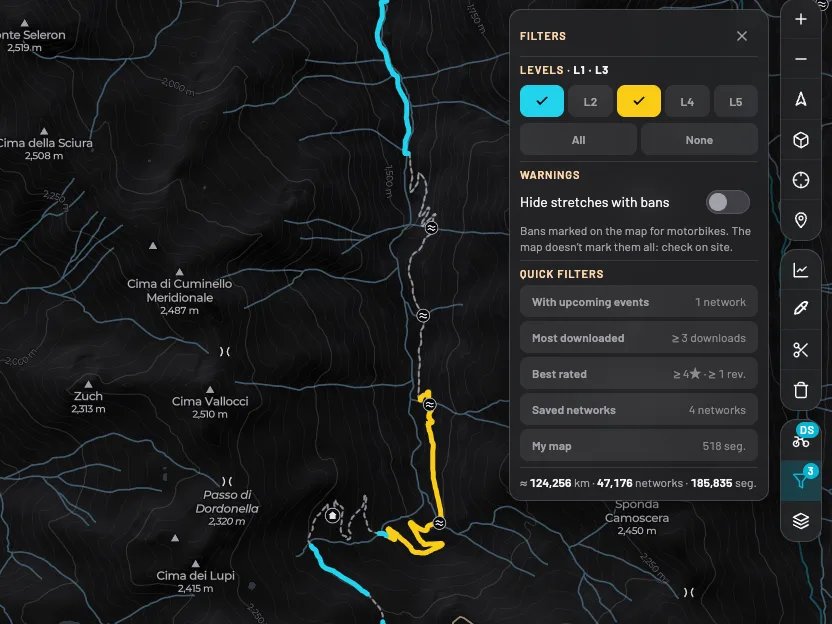
OffMap shows every dirt road in Italy, for motor vehicles and bicycles: about 58,000 networks and 280,000 stretches in 20 regions, taken from OpenStreetMap without footpaths: routes marked as pedestrian or hiking are left out. Each network is a set of connected stretches; each stretch has a length, a surface and a level.
On the Explorer plan the map filters whole networks; with Explorer Plus you pick single stretches, including with the brush right on the map.
Levels, from where you sit
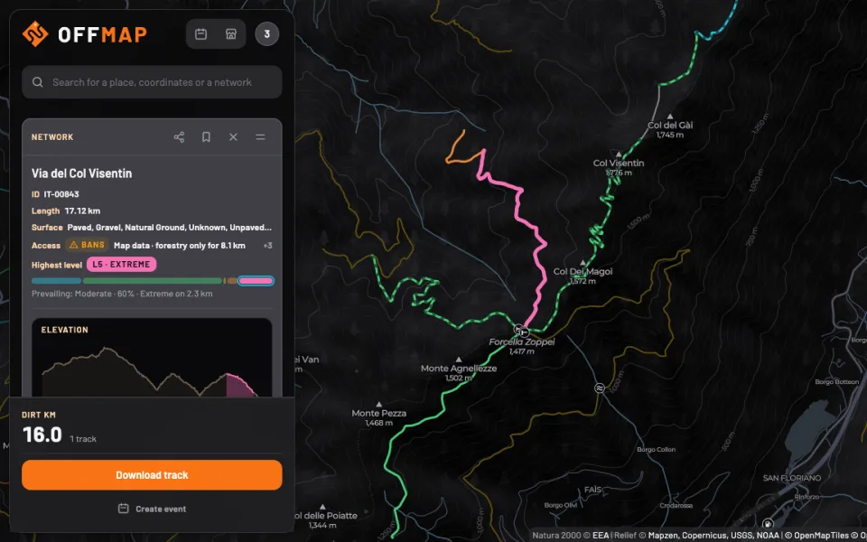
Every stretch has a difficulty score worked out from gradient, surface and twistiness. The level you see depends on the vehicle you choose: the same stretch can be moderate for an enduro and hard for a maxi enduro. A network takes the level of its hardest stretch.
- Maxi Enduro · Heavy twin-cylinder bikes (> 200 kg)
- Dual Sport · Light, versatile bikes (140-160 kg)
- Enduro · Pure enduro bikes (< 120 kg)
- MTB · Mountain bikes and e-bikes
Choose your vehicle from the garage in your profile: the map, the tracks and the level filter update to match. With Explorer Plus the filter also keeps stretches above your level out of the itinerary and the GPX; with Explorer it hides whole networks whose hardest stretch is above your level.
Tracks and itineraries
With Explorer every network’s GPX is free: pick one or more networks and download them as separate tracks, as often as you like. An itinerary, a single ride with the transfers already worked out, you preview for free and download with Explorer Plus or with a single itinerary.
- free
- free
- free
- Explorer Plus or a single itinerary for €2.99
- free
- 30 days of Explorer Plus, no card needed
Explorer Plus
With Explorer Plus you download every itinerary without paying for it separately, pick single stretches, cut and erase what you don’t want to ride, join several networks into an itinerary with the transfers worked out, ask the AI agent for today’s council orders, save itineraries and organise events without limits. When you sign up you get 30 days free; then it costs €4.99 a month or €39.99 a year, renews automatically and you cancel it from your profile: you stay on Plus until the end of the period you paid for.
Itineraries and GPX
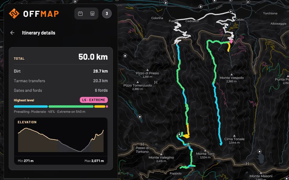
Select networks or stretches and choose the shape: one way or loop. OffMap links the dirt stretches with transfers on tarmac. The one exception is a network you chose that can’t be reached from tarmac: OffMap links it over other dirt roads, never harder than that network, and shows the link separately in the itinerary and the GPX. Sometimes a transfer runs over a short stretch that road maps class as tarmac and OffMap as dirt road: you see it dashed, with its km shown separately. You can change the order of the stops and move the waypoints. Then you download a GPX file and open it in the navigator you already use: you see the whole track, with a point at the start of each network and its name, and follow it like any other track.
Access: map, law and AI
On the map
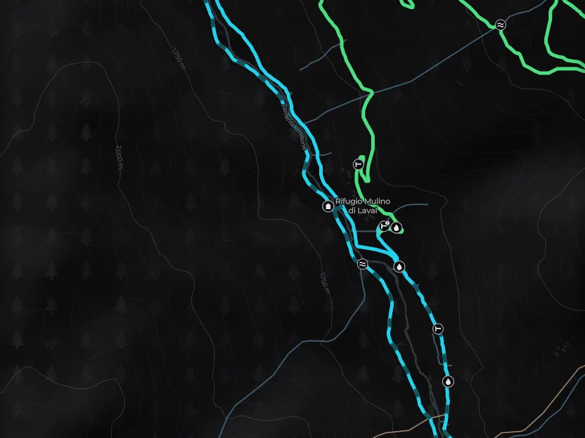
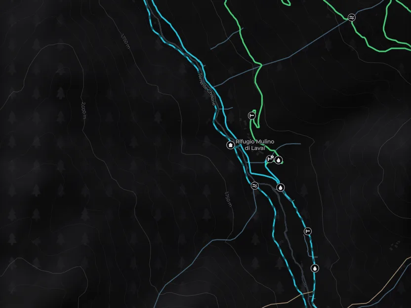
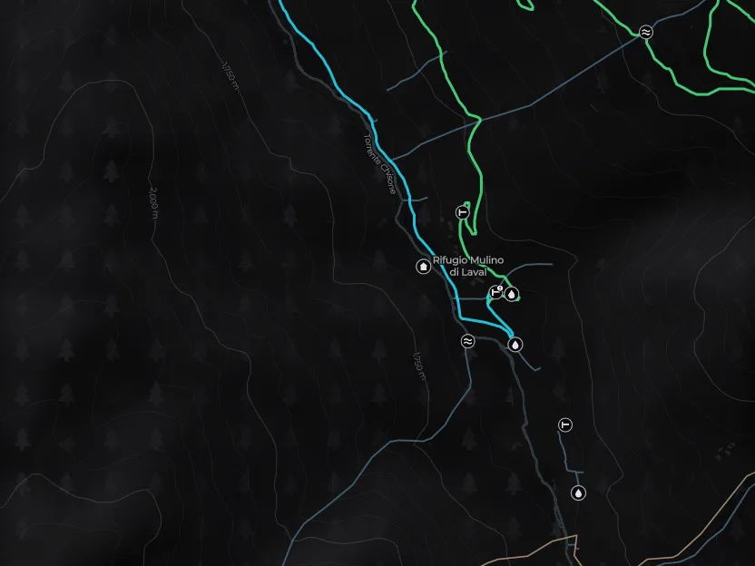
Stretches with a ban in the OpenStreetMap map data for your vehicle are dashed up close and fainter from afar. Up close, gates, barriers and fords have their own mark too, with an exclamation mark where the map records a ban: tap them to see what they are. The map data doesn’t show everything: there can be a gate where the map shows none.
On the card
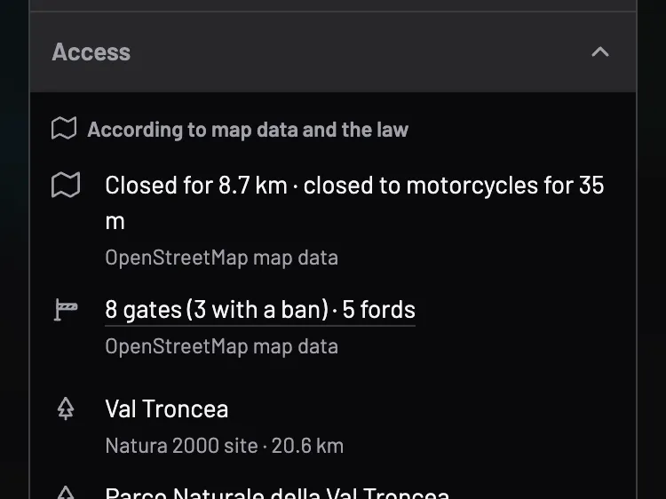
Every network has an ‘Access’ section, for everyone, and a ‘Bans’ badge when it has bans for your vehicle: the bans in the map data, the gates and fords the map marks along the route (the GPX marks them too), the protected areas it crosses (parks and reserves from OpenStreetMap, Natura 2000 sites from the European Environment Agency) and the regional law on motor traffic, where there is one. With Explorer Plus, on request, the AI agent looks for council orders, closures and news from the municipalities the network crosses, downloads the sources and gives you a verdict with a link to what it read: open, restricted, closed, or ‘no source found’. The verdict lasts 48 hours and is a guide only.
From the ground
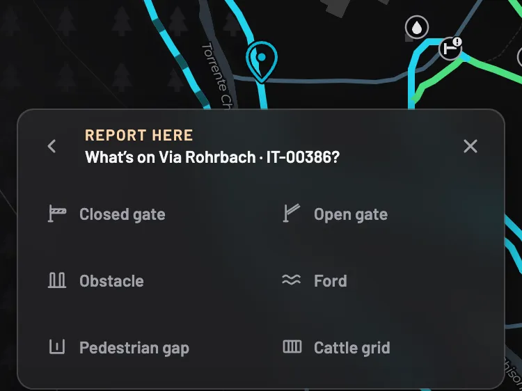
A closed or open gate, an obstacle, a ford, a pedestrian gap or a cattle grid the map doesn’t show is reported from the point card and appears on the map straight away as ‘to be confirmed’, then, once a second explorer confirms it, it goes on the card and in the GPX, for 90 days for gates and obstacles and 12 months for the rest; an obstacle on the map that is no longer there is removed with ‘No longer there’ and two confirmations, for 12 months. Reviews from other explorers complete the picture with the real surface.
The filter
To take the stretches with a ban for your vehicle off the map (with an MTB, for bikes), turn on ‘Hide stretches with bans’ in the map filters: the rest of the network stays. Like the level filter, those stretches also leave the km, the GPX, itineraries and the Route suggestions: you count and download only what you see. The filter stays off until you turn it on.
Events
From a track you created you post a ride with meeting point, date, pace and allowed vehicles; riders who join see the track and, once the minimum number is reached, the group link to get organised. The organiser creates the WhatsApp or Telegram group and pastes the link into the form; riders see it once the minimum is reached. The board shows upcoming rides in your region. With Explorer you have one active ride at a time; with Explorer Plus there are no limits.